|

Image A:
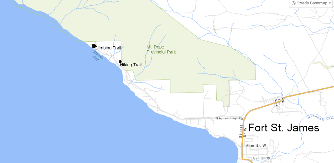 Fort St. James Local Map
Image B:
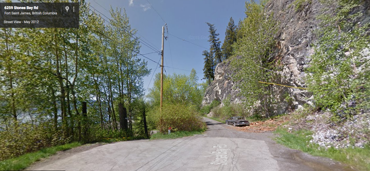 Image B: End of public road, Stones Bay Rd.
Image C:
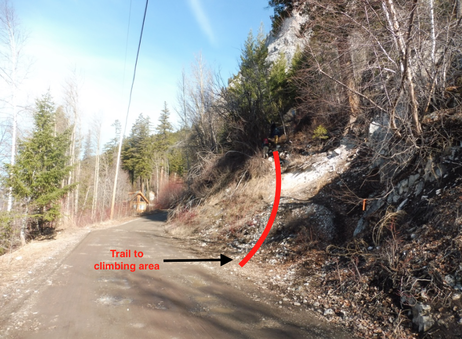 Image C: Trailhead to Mt. Pope Climbs
|
Image A:
Fort St. James Local Map
Image B:
Image B: End of public road, Stones Bay Rd.
Image C:
Image C: Trailhead to Mt. Pope Climbs